

Create Your Own Elevation Maps with AI
Make your own detailed and accurate elevation maps with our free AI image generator. It's easy and fast!


3 years ago
elevation map of north america, very high detail and accuracy, color-coded, realistic abstract vector fractal, wave function, Zentangle, 3d...
Erstellt vor 3 years ago · 0 kommentare· 0 Likes
 SDXL 1.0
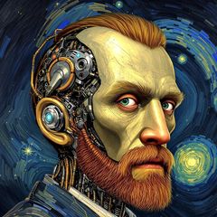
Kreationsübersicht von Vincent
Detailed Color-Coded Elevation Map of North America
A highly detailed and accurate color-coded elevation map of North America. This striking image employs realistic abstract vector fractal techniques with 3D shading to visualize the terrain.
Erstellt von Autumn on Mars am Mar 10, 2024 unter Verwendung des SDXL 1.0 KI-Bildgenerator-Modells.
Noch keine Kommentare
Seien Sie der Erste, der antwortet!

No comments yet.
Kreationseinstellungen
- Text-Prompts
- elevation map of north america, very high detail and accuracy, color-coded, realistic abstract vector fractal, wave function, Zentangle, 3d shading head and shoulders portrait, 8k resolution concept art portrait by Greg Rutkowski, Artgerm, WLOP, Alphonse Mucha dynamic lighting hyperdetailed intricately ...Weight: 1
- Modell
 CKPT
- Anfangsauflösung
Medium
- Seitenverhältnis
16:9
- Laufzeit
Short
- Gesamt-Prompt-Gewicht
85%
- Verfeinerungsgewicht
10%
- Abtastmethode
K_DPMPP_2M


